Here are a few maps before we talk about tomorrow:
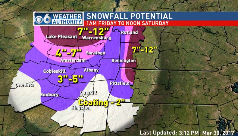 |
| Channel 6 Albany |
 |
| Channel 10 Albany |
 |
| National Weather Service Albany |
Really, it's just mess. The latest models are definitely leaning toward longer periods of sleet and freezing rain, which they were not indicating earlier in the week. The predicted temperature is still a moving target--some models show warmer and others have the cold air in place longer. This is just to say that we could see 1 inch or we could see 10 inches. Elevation and north/south location will make a big difference tomorrow.
Despite the uncertainty, this is what the GSD Staff thinks is going to happen. It will be snowing or sleeting during decision time for Superintendents tomorrow morning, especially north of I-90. Most will choose to go with a full school day because the roads won't be too bad. Because of the threat for ice and power outages, one or two will get nervous and opt for the snow day. The likely candidates are North County schools as well as Central Berkshire, due to the higher elevation. Then, if we get an extended period of sleet and freezing rain, we could see some schools call the early release and let the youngsters get a head start on their weekend. Schools south of I-90 are probably going to have a full day, with a slight chance of a delay.
The Staff will be up early. We'll update on the storm and run a list, should schools opt out tomorrow.
No comments:
Post a Comment